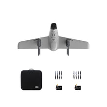
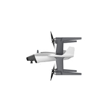
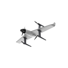
The Swan K1 Mapping wing is the tool mapping and surveyors are using to get the job done. Fast, Accurate and efficient.
1 hour flight time | 24MP high resolution | Centimeter accuracy | 2-9 square kilometers per flight | PPK module, easy to handle


|
Specification |
|
|
Camera |
|
|
Size : |
75×65×90mm(include 25mm lens) |
|
Weight: |
220g( include lens ) |
|
Pixel: |
24.3 million pixels |
|
Camera frame: |
APS frame |
|
Sensor size: |
23.5×15.6mm |
|
Miximum resolution: |
24MP |
|
Lens mount: |
Sony E mount |
|
Access current: |
2~7S 10~30V |
|
PPK module |
|
|
Operating Temperature: |
-30~+75℃ |
|
GNSS Signal: |
GPS、GLONASS、BDS、Galileo |
|
GNSS channel: |
72 |
|
Update rate : |
10Hz/5Hz |
|
Input voltage : |
5V |
|
Antenna voltage: |
3.3V |
|
Average current : |
25mA |
|
Data storage : |
16GB |
|
Data Format : |
RINEX |
|
Antenna interface : |
Mcx |
|
Light: |
Trigger, satellite, storage, power |
|
Horizontal accuracy: |
2cm+1ppm |
|
Vertical accuracy : |
4cm+1ppm |
|
Work efficiency |
|
|
Overlap rate: |
80×70 resolution 5/10/20 cm 60min flying time |
|
1:500 Flying height 210m: |
2-3 square kilometers per flight |
|
1:1000 Flying height 420m : |
4-5 square kilometers per flight |
|
1:2000 Flying height 840m: |
8-9 square kilometers per flight |
|
Operation accuracy |
|
|
1:500 Phase-free : |
Horizontal accuracy≤ 5cm |
|
Height accuracy≤ 5cm |
|
|
1:1000 Phase-free: |
Horizontal accuracy≤ 8cm |
|
Height accuracy≤ 10cm |
|
|
1:2000 Phase-free: |
Horizontal accuracy≤ 15cm |
|
Height accuracy≤ 20cm |
|
What is in the box
1x Swan-K1 Mapping aircraft ;
2x set of quick detachable nylon propellers ;
1x Radio controller(with HD touch screen);
1x Carry case;
2x 5500mAh 15.2V Lipo Battery;
1x Power charger;
1x Aircraft User Manual and Disclaimer;
1x Custom 24 Mega pixels SONY camera;
1x PPK module;


